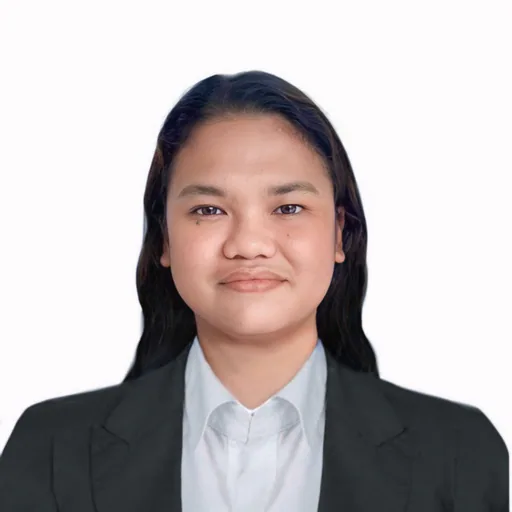
MOLLY D.
Junior Land Surveyor
Open to offersNew to PlatformAbout
Molly D. is an experienced Land Surveyor and academic specializing in geomatics, with a background spanning land development, construction, agriculture, education, and geospatial technology. As a freelance surveyor, she plans and executes land surveys using GPS and total stations, compiles technical reports, and prepares legal boundary documentation for property projects. At Batangas State University, she lectures on geodetic engineering, delivering curriculum-aligned lessons and assessments. Her roles in companies like RockRobotic, Vara3D, and Ceres Imaging involved GIS and LiDAR data processing, 3D modeling, spatial analysis, and QA/QC, directly supporting mapping, construction, and agricultural projects. Molly is proficient in Civil 3D, QGIS, ArcGIS, and remote sensing, with technical project experience including suitability analysis for urban bicycle tourism and remote crop detection using GIS and spectral mapping techniques.
Experience
GIS/LIDAR Processing Technician
RockRobotic · 2024 — 2025Conducted QA/QC of LiDAR data to ensure quality control in data processed by the Rock Robotic platform, managing this responsibility as a primary task on a daily basis. Facilitated internal communications by keeping team members informed about project progress, identifying software issues, and sharing customer feature requests, which contributed to workflow efficiency. Rectified projection and Ground Control Point (GCP) errors introduced by users to ensure data accuracy. Managed external communications with users of the ROCK Cloud software to address and resolve concerns regarding LiDAR data and deliverables.Drafter
Vara3D · 2023 — 2025Utilized AutoCAD Civil 3D to define legal property boundaries, enhancing project accuracy through precise survey adjustments and staking. Assessed the accuracy of registrations and 3D models, aiding in the reliability of data for construction planning. Processed LiDAR data to produce 2D drafts, optimizing analysis of survey data and facilitating detailed project visualization.GIS Analyst
Ceres Imaging · 2024 — 2024Employed Geographic Information Systems (GIS) to analyze agricultural data designed for precision farming, specifically utilizing QGIS for georeferencing raster images to base maps and editing shapefiles. Enhanced project accuracy through careful data input and management while leveraging advanced GIS techniques to optimize agricultural practices, contributing to increased efficiency in precision farming initiatives.GIS Consultant
KI Manpower · 2023 — 2023Assisted in the formulation of a technical project proposal that aligned with the GIS and land surveying requirements of the company.Land Surveyor
Freelance · 2022 — PresentPlanned and conducted land surveys to accurately ascertain and mark property boundaries for clients. This involved field measurements and the establishment of control points for precision. Employed survey instruments, including GPS, total stations, and levels, to gather data regarding elevations, distances, and angles, and analyzed this information to verify measurements and detect discrepancies. Compiled findings into technical reports and drafted detailed lot plans, maps, and sketches that delineated property lines and significant features. Prepared and interpreted legal descriptions, boundary maps, and deed information in accordance with property records and regulatory standards. Collaborated with clients, architects, engineers, and government agencies to supply accurate data for land development, construction projects, and property transactions. Utilized GIS software to merge spatial data, enhancing mapping accuracy and supporting land use planning analysis as necessary.College Lecturer (BS Geodetic Engineering)
Batangas State University · 2022 — PresentDeveloped, prepared, and delivered lessons that were aligned with curriculum standards and learning outcomes. Created an engaging educational atmosphere by actively involving students through lectures, discussions, and interactive activities. Designed and administered assessments, assignments, and examinations while providing prompt feedback and fair evaluations to facilitate student advancement. Revised and improved course materials and curriculum to maintain relevance and conformity with academic standards and industry practices.Technical Support Specialist
Teleperformance, Inc. · 2019 — 2022Delivered phone-based technical support, addressing issues related to VOIP phone services, internet connectivity, and TV services. Guided customers through troubleshooting steps, which included modem resets, troubleshooting TV issues, and configuring devices. Logged and tracked support cases using CRM and ticketing systems accurately. Informed customers about product features, upgrades, and service options to enhance their overall experience.On-the-Job-Trainee
Certeza Infosysy Corp. · 2018 — 2018Applied knowledge from coursework such as surveying, remote sensing, and GIS applications during the internship. Coordinated with the assigned supervisor on tasks while ensuring timely submission of reports at the end of each day. Collaborated with Geodetic engineers and other professionals on a subway project.Data Collector
RC Tollo Surveying Services · 2016 — 2017Collected field data, secured necessary logistical requirements such as barangay permits, and prepared weekly investigative reports.
Skills & Expertise
Education
- MS in Geomatics Engineering Major in GeoinformaticsUniversity of the Philippines - Diliman
- Bachelor of Science in Geodetic EngineeringUniversity of the Philippines - Diliman
Interested in this professional?
Sign in as an employer to save this profile or invite MOLLY D. to a job.
Sign in as an employer